
Professor Yue Yang from The Hong Kong University of Science and Technology (Guangzhou) was invited to deliver a lecture at the “Chen Shu-Peng Lecture Series / Xudan Lecture Series.”
On November 14, 2025, the School of Geography at Nanjing Normal University hosted a special lecture titled “From Large Language Models to Urban Large Models” as part of its “Chen Shupeng Lecture Series/Xudan Lecture Series.” Professor Yue Yang from The Hong Kong University of Science and Technology (Guangzhou) was invited to deliver the presentation. The lecture, chaired by Professor Fu Xiao, drew a large audience of faculty and students, filling the venue to capacity and fostering a lively atmosphere of exchange.
During the lecture, Professor Yue Yang systematically explored cutting-edge topics in geospatial artificial intelligence, highlighting her team's innovative research on integrating geospatial data with large language models. She noted that while AI technologies represented by large language models have achieved breakthroughs in text, image, and video processing, their underlying architectures still face challenges when handling vector map data with complex spatial relationships. Professor Yue Yang innovatively introduced the core concept of “Geospatial Tokenization,” aiming to construct “minimal spatial units” for map data analogous to textual words. This approach enables AI to genuinely “understand” and process spatial relationships.
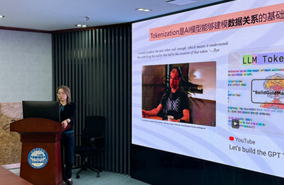
Professor Yue Yang elaborated on the technical approach proposed by his research team: using the urban road network as the skeletal framework for dividing urban space, treating land parcels as spatial units, and employing technologies such as dynamic location reference coding to encode relative spatial relationships (e.g., distance, topology, direction) between elements into high-dimensional vectors. Through illustrative cases like predicting foot traffic in unknown plots and identifying urban functional zones, the approach vividly demonstrates its potential to effectively reconstruct and forecast urban spatial structures and dynamics even with partial gaps in traditional data. Professor Yue Yang emphasized that this “GeoEmbedding” strategy—embedding spatial relationships into the model's foundation—represents a crucial step toward achieving a truly comprehensive “urban large model,” offering a new analytical paradigm for fields including urban planning, traffic management, and social sensing.
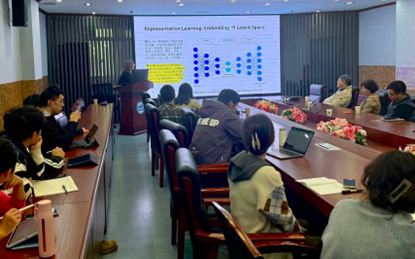
During the interactive session of the lecture, faculty and students engaged in an in-depth and thought-provoking discussion on cutting-edge topics such as the universality of geospatial tokens and the significance of latent and manifest spaces, elevating the academic discourse to its peak.
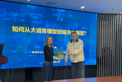
Professor Lü Guonian presented Professor Yue Yang with the appointment letter as a lecturer for the “Chen Shupeng Lecture Series/Xudan Lecture Series” on behalf of the school. This lecture was rich in content and forward-looking in perspective, sharing the broad application prospects of the cross-disciplinary integration of geospatial intelligence and large AI models, delivering an academic feast for the faculty and students in attendance. The entire presentation provided crucial theoretical insights and innovative pathways for the geoinformation science community to seize opportunities and achieve leapfrog development in the era of general artificial intelligence.